Introduction
There are three key sub-themes under the water theme:
1. Waterways
- Rivers and streams
- Estuaries
- Wetlands
2. Floodplains
3. Water resource
Waterways
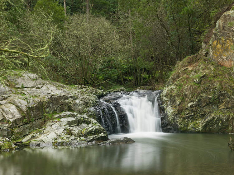
Rivers and streams
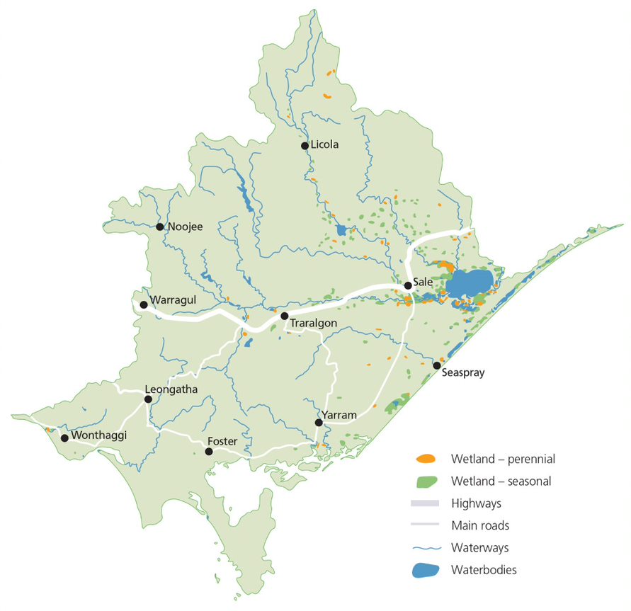
The West Gippsland region includes three river basins:
- Thomson
- Latrobe
- South Gippsland
The major waterways include the Thomson, Macalister, Avon and Perry Rivers (Thomson Basin), Latrobe, Tyers and Tanjil Rivers (Latrobe Basin) and the Powlett, Tarwin, Franklin, Agnes, Albert and Tarra Rivers (South Gippsland)
All of these waterways flow to the Victorian coast via lakes, estuaries and inlets. The region’s rivers support a range of environmental, social, recreational and cultural values. They also provide water for towns, industry and food production11.
Estuaries
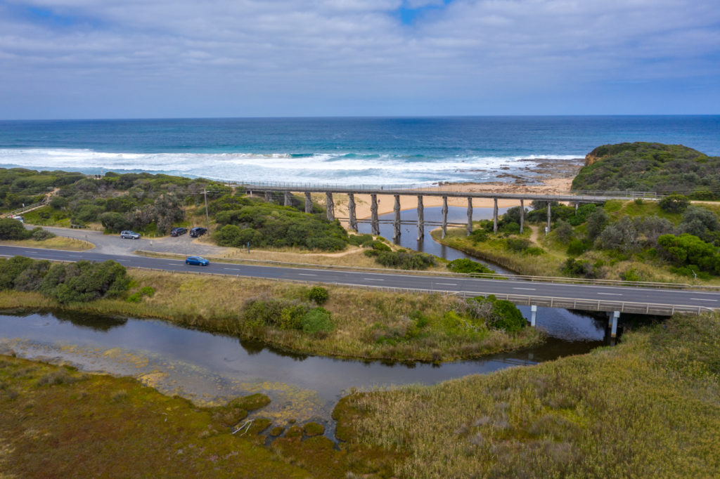
The region’s estuaries are an important link between the ocean and land, where fresh water from rivers and streams mixes with salty marine waters. Estuaries are dependent on both of these water sources to provide a diverse and healthy environment. The estuaries in the West Gippsland catchment area range from near natural to highly modified, and include:
- Bourne Creek, Powlett River, Wreck Creek
- Ayr Creek, Screw Creek, Anderson Inlet
- Darby River, Tidal River and estuaries of Corner Inlet and the east side of Wilsons Promontory
- Merriman Creek
- Estuarine reaches associated with Lake Wellington and the Gippsland Lakes (Latrobe and Avon Rivers)12.
Estuaries are also an important component of the Coasts and Marine theme, additional information can be found in that section of the website.
Wetlands
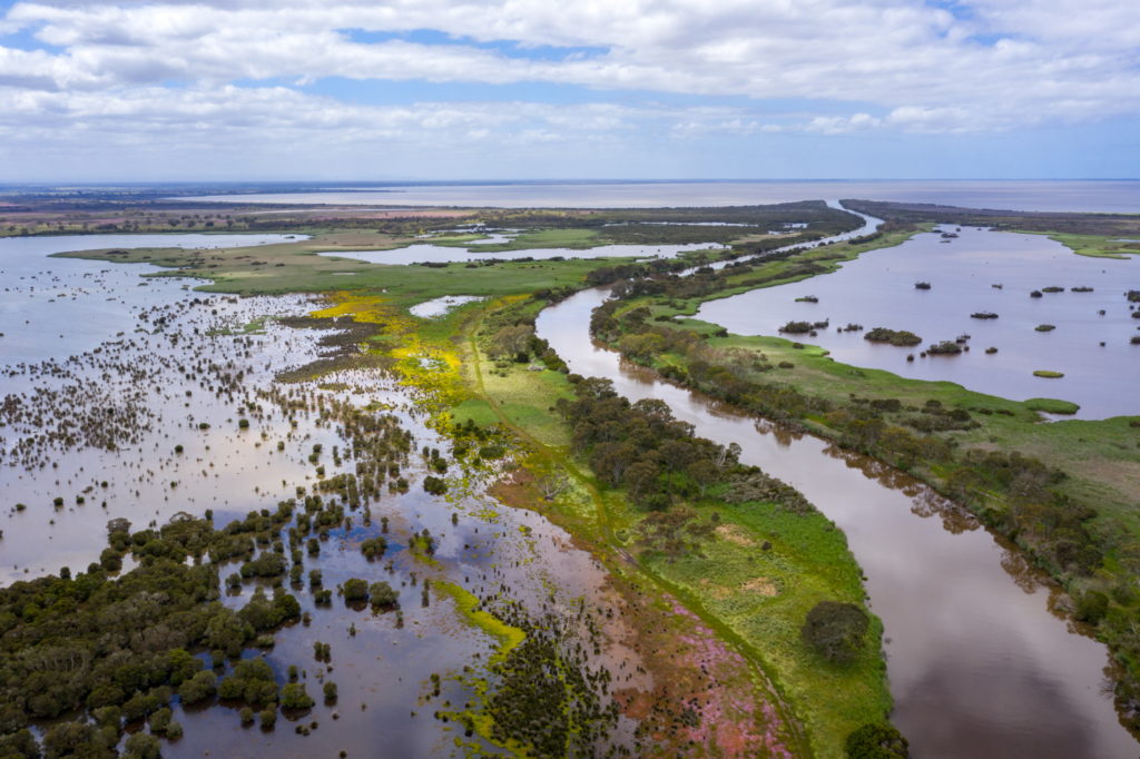
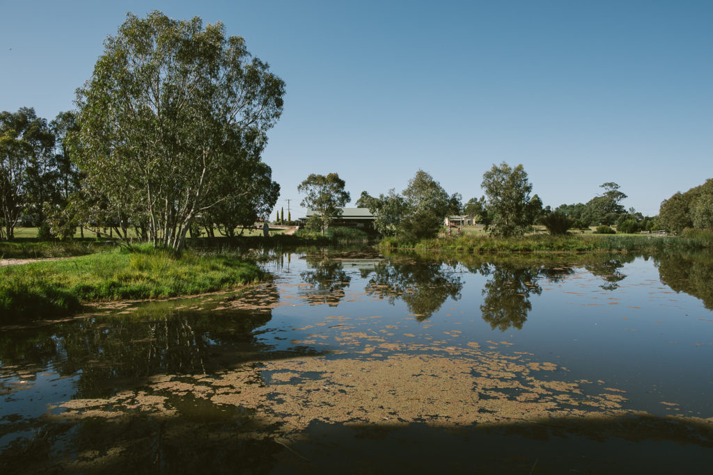
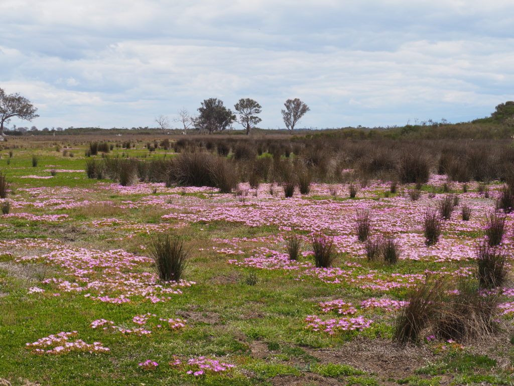
There are over 1,500 wetlands larger than one hectare in our region. Together they total more than 44,000 hectares.
Corner Inlet and the Gippsland Lakes are wetlands of international importance under the Ramsar convention and are critical habitats for many vulnerable and threatened species, including migratory bird species listed under the Japan-Australia Migratory Bird Agreement (JAMBA), China Australia Migratory Bird Agreement (CAMBA) and Republic of Korea-Australia Migratory Bird Agreement (ROKAMBA).
There are eleven sites in West Gippsland listed as nationally important under the Directory of Important Wetlands Australia12.
Floodplains
Flooding
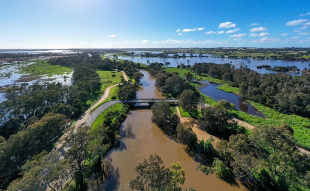
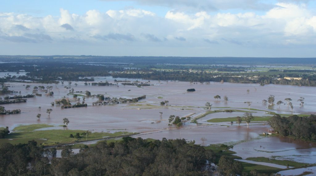
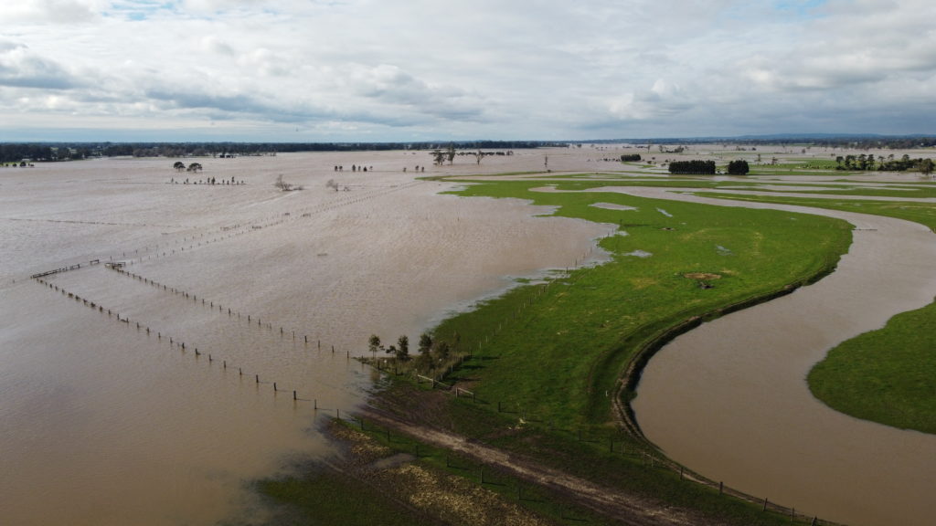
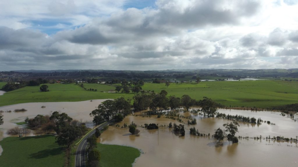
Flooding is a natural hazard in West Gippsland that can severely disrupt communities by causing injury, loss of life, property damage, personal hardship, and disruptions to regional economies.
The location, scale of effects and the probability of occurrence can be estimated with reasonable accuracy for a range of floods.
Understanding flood behaviour enables agencies and communities to assess the likely costs of flooding and the benefits of different options for managing the community’s exposure to flood risk.
Development within the floodplain can increase the exposure of people and property to flood risk overtime if not appropriately assessed and managed. State Planning Policy 13.03-1S Floodplain Management seeks to avoid intensifying the impact of flooding through inappropriately located use and development.
To implement this policy the WGCMA has developed, through consultation with the West Gippsland community, a set of clear and transparent Guidelines for Assessing Development in Flood Prone Areas. These guidelines are used to assess typical development types against different levels of flood hazard and provide clear direction on what type of development is appropriate within West Gippsland’s diverse and unique floodplains
Waterways are dynamic as they are acted on by complex processes that alter their form and capacity over time. In general, waterways will meander more over time, which cuts into adjoining land, damaging property, buildings and roads. Bank erosion and changes in flow capacity can increase flooding on adjoining land.
Integrated Catchment Management seeks to strike a balance between the socio-economic impacts of flooding and waterway health.
In the past, flood mitigation relied heavily on channel modification and levee construction. Towards the end of the 20th century, it became apparent that activities like these are often expensive, have negative impacts on the environment and on flood behaviour, and create significant problems when they fail or are overtopped2.
Channel deepening and straightening generally increases flood height and velocity downstream, exacerbating flood impacts and erosion in the lower reaches.
It also disconnects the waterway from its floodplain, which impacts on riparian vegetation and habitat. By transferring floodwaters to other locations, levees have similar impacts to channel deepening. They also require maintenance and are at risk of overtopping or failure.
Contemporary approaches to floodplain management include a mix of interventions that aim to reduce flood risk with consideration to environmental, social and cultural values1.
Water Resources
About 92 per cent of the water extracted for towns, industry and agriculture in Gippsland is sourced from waterways, about eight per cent sourced from groundwater and a small proportion drawn from alternative sources such as stormwater and recycled wastewater11.
Surface Water
The West Gippsland region has valuable surface water resources for environmental, agricultural, industrial, urban and potable water supply purposes.
The region has 24 of Victoria’s 134 declared water supply catchments, which supply water for both stock and domestic purposes and are protected under the Catchment and Land Protection Act. This process highlights to the community, land managers and planners, the importance of the catchment for water supply purposes11;12.
The Thomson Basin and the Latrobe Basin both drain the southern fall of the Great Dividing Range and the northern slopes of the Strzelecki Ranges into Lake Wellington. The South Gippsland Basin’s ten major rivers and streams drain the southern slopes of the Strzelecki Ranges to the coast and inlets between San Remo in the west and Loch Sport in the east11.
Groundwater and aquifers
The West Gippsland region is a rich source of groundwater, suitable for livestock, domestic, garden and industrial use. In some areas, particularly along the Gippsland Coastal Plain and Gippsland Lakes and Hinterland the high yielding aquifers are important sources of water for irrigation and town water supply, including major city centres like Sale in the east3. Groundwater also contributes to the environmental values of some ecosystems. These are known as groundwater dependent ecosystems (GDEs) and can include waterways, wetlands, springs, estuaries and vegetation.
Aquifers in Gippsland
Upper aquifers are thin and occur at shallow depths along the river valleys and flood plains and in dune deposits near the coast. These aquifers discharge to streams, wetlands and the Gippsland Lakes.
Middle aquifers occur within the central Gippsland area and their formation is complex comprising upper-middle and lower-middle layers. They are generally buried beneath confining layers. In some parts these aquifers are nearly one kilometre thick.
Lower aquifers extend across the region. They occur at or close to the surface near Moe and Leongatha and along the basin margin, becoming very deep along the coast. Basement rock occurs at the surface in the highlands and is buried under the lower aquifers along the coast. Discharge from these aquifers occurs offshore into Bass Strait4.
Condition and Trends
Rivers and streams
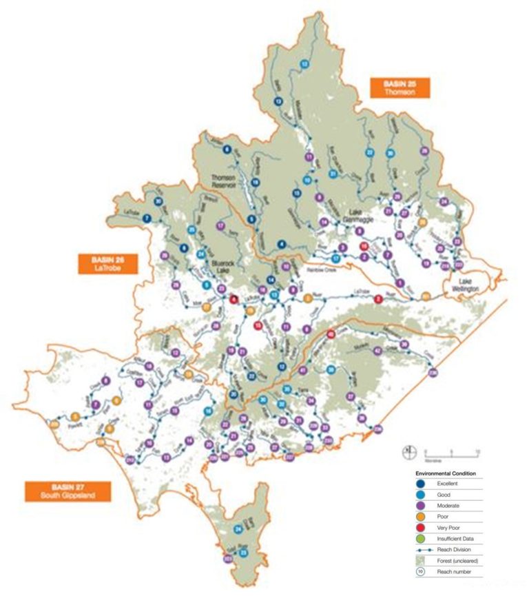
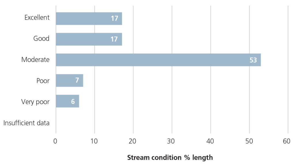
The majority of stream reaches assessed in the region were in ‘moderate’ condition, based on the last index of Stream Condition benchmark conducted in 2010.
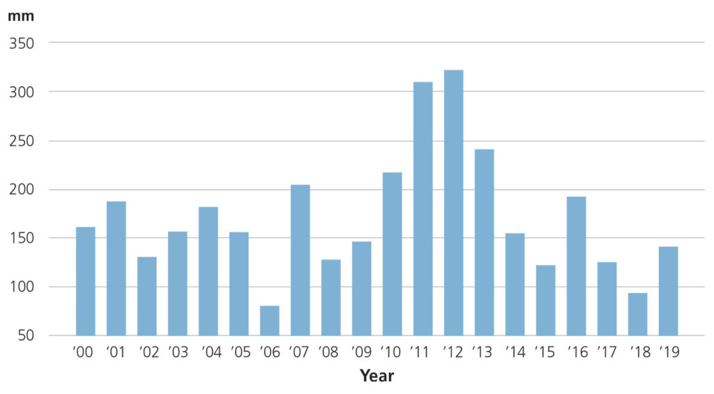
Approximately one third (34%) of stream reaches in West Gippsland assessed were in ‘excellent’ or ‘good’ condition, mostly located in the Thomson and Latrobe basins5. Streamflow was above the long-term average from 2010-11 to 2011-12 and closer to, or slightly below the long-term average from 2013-14 to 2014-156.
Implementation of the Regional Catchment Strategy, and the West Gippsland Waterway Management Strategy has seen significant investment in waterway improvement over the past six years.
Riparian zone protection or improvement in the West Gippsland region
| OUTPUT | 14-15 | 15-16 | 16-17 | 17-19 | 18-19 | 19-20 |
|---|---|---|---|---|---|---|
| 1. STRUCTURAL WORKS | ||||||
| 1.2 Water storage | 16 | 15 | 11 | 29 | 29 | 23 |
| 1.9 Fence (km) | 43 | 40 | 44 | 68 | 62 | 42 |
| 2. ENVIRONMENTAL WORKS | ||||||
| 2.1 Vegetation (ha) | 366 | 129 | 183 | 210 | 200 | 105 |
| 2.2 Weed control (ha) | 1,308 | 1,733 | 2,249 | 4,496 | 2,429 | 2,442 |
| 2.8 Earth works (no.) | 2 | 5 | 5 | 3 | 12 | 22 |
| 4. PLANNING AND REGULATION | ||||||
| 4.2 Management agreements (no.) | 36 | 33 | 38 | 56 | 48 | 63 |
Wetlands
The Index of Wetland Condition (IWC) was developed to assess the condition of Victoria’s wetlands. Of the 72 sites assessed between 2009-2013, the majority were in moderate to good condition (18 and 29 respectively), 12 were in excellent condition and 15 were in poor to very poor condition11.
Note: 72 wetlands in the West Gippsland region were assessed between 2009 and 2013 using the IWC. Twenty-six of these were part of a state-wide assessment of wetland condition and the remainder were completed to inform the selection and or monitoring for on-ground works.
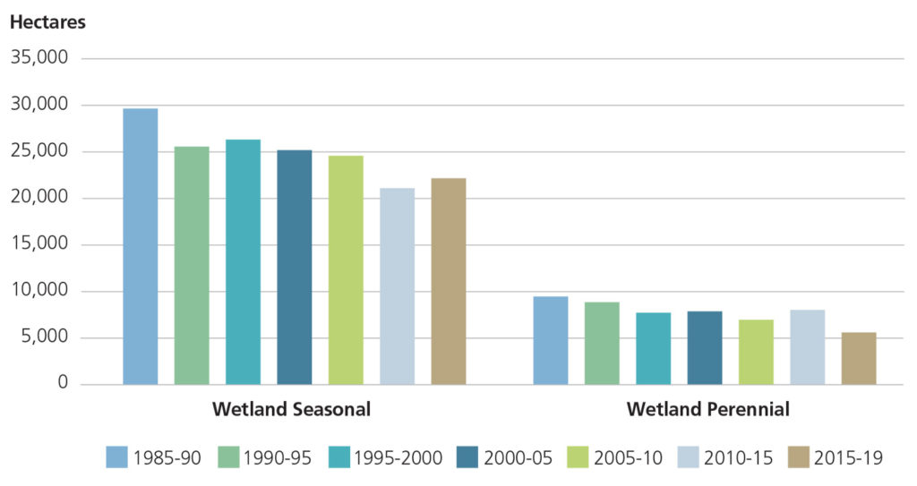
Assessment of Landcover data indicates there was a loss of both perennial and seasonal wetlands over the period 1985 to 2019. Seasonal wetlands declined by 25% (-7,564 ha) and perennial wetlands declined by 40% (-3,787 ha)7.
Surface water
The Long-Term Water Resource Assessment for Southern Victoria provides a summary of the condition and trends associated with water availability.
The long-term surface water availability has declined in the region (5-12%) compared to when it was last estimated for the sustainable water strategies in the mid 2000’s. The main cause of these declines are drier conditions. In some basins, upstream interception of water for storage in domestic and stock dams, and for forestry plantations, may also be contributing to the decline in surface water availability. Impacts from this decline may include increased costs for farmers (particularly for stock and irrigation water), commercial and urban users as well as a decline in stream and wetland condition. In some parts of the region declines in long-term surface water or groundwater availability have fallen disproportionately onto either consumptive uses or the environment. For example, in the Latrobe basin the decline in long-term surface water availability has not been shared equally: the environment now has a three percent smaller share of the available water9;11.
Long-Term Water Resource Assessment results by river basin9
| LATROBE RIVER | THOMSON RIVER | SOUTH GIPPSLAND | |||
|---|---|---|---|---|---|
| Total water available | 829.8 (GL/yr) | Total Water available | 914.10 (GL/yr) | Total Water available | 661.60 (GL/yr) |
| Consumptive share | 24% | Consumptive share | 39% | Consumptive share | 3% |
| Environment’s share | 76% | Environment’s share | 61% | Environment’s share | 97% |
| Decline in available water | 5% | Decline in available water | 12% | Decline in available water | 12% |
| Change in consumptive share | 3% | Change in consumptive share | 0% | Change in consumptive share | 0% |
| Change in environment share | -3% | Change in environment share | 0% | Change in environment share | 0% |
| Effect on consumptive share | Increase from 21% (3% change) | Effect on consumptive share | No Change | Effect on consumptive share | No Change |
| Effect on consumptive share | Decrease from 79% (3% change) | Effect on environment share | No Change | Effect on environment share | No Change |
Groundwater
Groundwater aquifers in the region provide water for domestic, agricultural and industrial use and support groundwater dependent ecosystems. The Long-Term Water Resource Assessment for Southern Victoria found that groundwater levels are declining in some areas of the region but are generally stable 9;11. Declines in groundwater availability may increase water demand, impacting the agricultural sector and the environment. For example, declining groundwater levels in the Latrobe Group aquifer are already impacting Yarram farmers by reducing their access to groundwater and increasing costs. This groundwater decline may also cause a decline in the surface water availability, such as the reduction seen in the Denison and Wa De Lock GMA, which can negatively impact stream condition and cause sea-water intrusion11.
A summary of the results for Groundwater Management Areas (GMA) and Water Supply Protection Areas (WSPA) in the West Gippsland region is provided in the table below.
Long-term declines in groundwater 9
| BASIN | GMA | AQUIFER | ASSESSMENT OF DECLINE |
|---|---|---|---|
| Thomson | Denison and Wa De Lock | Unconfined shallow | Decline ranging from 0.1-1m localised impacts on streamflow in the Avon and Macalister Rivers may occur during low flow periods when groundwater is used for irrigation Licensed groundwater pumping in the Wa de Lock GMA has reduced waterway flow in the Macalister and Avon Rivers by approximately 3.9 and 3.0 GL per year, respectively, which has contributed to the decline in surface water availability Licensed groundwater pumping in the Denison WSPA has reduced waterway flow by approximately 8.3GL per year, which has contributed to the decline in surface water availability |
| Thomson | Sale and Rosedale GMAs | Confined middle | Long term decline ≻2m |
| Latrobe | Moe GMA | Confined lower | Long term decline ≻2m |
| Latrobe | Stratford GMA | Confined lower | Groundwater levels have declined by ≻2. Declined steadily since the 1970’s at a rate of approximately 1m/year. Caused by dewatering around the Latrobe Valley coal mines and, near the coast, offshore oil and gas extractions which are connected to the lower aquifer* |
| Latrobe | Denison GMA | Unconfined upper | Long-term decline ≺1m |
| Latrobe | Unincorporated | Shallow groundwater | Modified around the Latrobe Valley coal mines where local declines in water levels are likely to have occurred |
| South Gippsland | Tarwin GMA, Leongatha GMA | Unconfirmed | Water levels have remained stable over the long term |
| South Gippsland | Giffard GMA | Confined | Long term decline ≺1m |
| South Gippsland | Yarram WSPA | Confined | Long term decline ≻2m |
| South Gippsland | Yarram WSPA | Lower confined aquifer | Groundwater has declined steadily since the 1970’s. This is due to offshore oil and gas extractions which are connected to the lower aquifer |
Major Threats and Challenges
The region’s waterways, wetlands and catchments have been impacted by past land use and river management practices. These include clearing of riparian vegetation, regulation of rivers and extraction of water, the introduction of invasive species and pollution from nutrients, sediments, pathogens and chemicals.
The loss of wetlands and decline in their condition is a major concern to the community and agencies. Preventing further impacts from threats such as development and climate change is a key challenge for the region.
Sustainable water resource use is also under pressure, with increasing demands for irrigation and the need to support growing populations and urban consumption7.
The millennium drought (1997-2009) saw a shift in the seasonality of rainfall, with big decreases in autumn rainfall leaving catchments drier at the beginning of winter, which led to less run-off from winter and spring rainfall. Climate change is also expected to continue to drive long-term reductions in rainfall and increased temperatures, which means this pattern from the Millennium Drought will be repeated. These drier catchments will impact both surface and groundwater availability11.
Despite the trend of an overall drier and warmer climate, intense rainfall events and the risk of flooding remain a major challenge in the region. Floods are part of the natural cycle of living in Gippsland. Flood risk occurs when we build, live and farm on the floodplain. Managing this risk requires the cooperation of a number of agencies and the community.
Major drivers of change – Water
| CLIMATE CHANGE | POPULATION AND DEMOGRAPHIC TRENDS | LANDUSE CHANGE | INDUSTRY OUTLOOK |
|---|---|---|---|
| ◾ Intense rainfall and flooding and erosion ◾ Decline in overall average rainfall impacting water regimes across the year | ◾ Households and industry in the region’s towns and cities will require more water ◾ Growing populations, rural subdivisions and fluctuating water availability are increasing demand for domestic and stock water | ◾ Shift from pasture to plantations, crops or the reintroduction of native vegetation, can affect the water balance of a catchment by intercepting water that would otherwise become part of the surface or groundwater resources ◾ Development pressures (e.g. in the south and west of the region) have the potential to impact on the condition of waterways, water quality and can result in the further loss of wetlands | ◾ Reductions in the volume of water required by power generators ◾ Changes to water sharing arrangements as a result of mine rehabilitation |
Opportunities and Management Directions
Priority management directions have been identified for the water theme, through a review of the RCS3 and consultation with Traditional Owners, the community and partner organisations.
Established management directions will be delivered through existing sub-strategies and action plans. Opportunities will be further developed or pursued through RCS implementation to help support Integrated Catchment Management in the region.
Priority opportunities and management directions for the Water Theme
| MANAGEMENT DIRECTION | DETAILS | ESTABLISHED MANAGEMENT DIRECTION | OPPORTUNITY | PARTNERS |
|---|---|---|---|---|
| Implement the Central and Gippsland Sustainable Water Strategy (SWS) (currently being renewed) | TBC | ✔ | Water Authorities, Traditional Owners, WGCMA, SRW, VEWH, GW, SGW, DELWP | |
| Implement the West Gippsland Waterway Strategy 2014-2022, renewing this strategy by 2023 | Priorities include actions associated with riparian and instream habitat, water quality, estuaries, wetlands and water for the environment | ✔ | WGCMA, Traditional Owners, Water Authorities, Local Government, Landcare, VEWH | |
| Implement the Lake Wellington Land and Water Management Plan, expanding to irrigators beyond the MID | Priorities include irrigation efficiency, managing the impact of salinity and high water tables, retention of sediment and nutrients on farm, protecting cultural values and industry partnerships | ✔ | WGCMA, Agriculture Victoria, DELWP, EPA, SRW, Gippsland Water, Industry bodies | |
| Implement the West Gippsland Regional Floodplain Management Strategy 2018-2028 | Priorities include flood studies, warning systems information provision, infrastructure and planning scheme measures | ✔ | WGCMA, Local Government, DELWP, Vic SES | |
| Implement the Gippsland Lakes and Corner Inlet Ramsar Sites management plans | Addressing priority threats to critical components, processes and services | ✔ | ✔ | WGCMA, EGCMA, Traditional Owners, DELWP, Parks Victoria |
| Investigate and implement options to address water recovery targets to benefit the environment, Traditional Owners and recreational uses | Including complementary measures to address constraints and support improved outcomes | ✔ | ✔ | WGCMA, Traditional Owners, VEWH, DELWP |
| Support implementation of the Latrobe Valley Mine Rehabilitation Strategy | Initial priorities are to participate in investigations for water and non water-based rehabilitation options | ✔ | DELWP, Mine Land Rehabilitation Authority, Traditional Owners, LCC, WGCMA | |
| Investigate options to improve water security for domestic, industrial and agricultural users while protecting flows for environmental and Traditional Owner values | ✔ | SRW, DELWP, Traditional Owners, GW, SGW, WGCMA | ||
| Implement the Victorian Alpine Peatlands Spatial Action Plan | Priorities include control of deer and transformative weeds and managing recreational access | ✔ | WGCMA, Parks Victoria, NECMA, GBCMA, EGCMA | |
| Investigate and implement options to minimise the loss of wetlands from climate change and changes in land use and management | Options include planning scheme measures (e.g. Bass Coast Statement of Planning Policy), management agreements and permanent protection | ✔ | WGCMA, DELWP, TfN, Local Government | |
| Deliver agreed projects identified in the Gippsland Integrated Water Management forum Strategic Directions Statement to maximise regional benefits (currently being renewed) | TBC | ✔ | Gippsland Water, South Gippsland Water, Local Government, WGCMA, Traditional Owners, DELWP, Parks Victoria | |
| Undertake a long-term groundwater resource appraisal for the Latrobe Group Aquifer | Considering mine rehabilitation scenarios | ✔ | DELWP, WGCMA, SRW | |
| Progress the implementation of options to reduce the long-term decline of the Yarram WSPA | ✔ | DELWP, WGCMA, SRW | ||
| Ensure shallow groundwater management considers the need to manage salinity and resource implications | ✔ | DELWP, WGCMA, SRW | ||
| Deliver integrated catchment management initiatives in priority catchments | Perry River and Providence Ponds, Powlett River catchments (priorities in 2021) | ✔ | WGCMA, Traditional Owners, Community representatives, Landcare, DELWP, DJPR, Local Government, Parks Victoria, TfN, Water Authorities | |
| Work with the community in priority areas to prepare whole of landscape integrated catchment management plans | Initial priorities include the Tarwin catchment and the Strzeleckis | ✔ | As above |
Regional Outcomes
This section sets out the long term (20-year) and medium term (6-year) outcomes as they relate to the region’s water assets. The outcomes include those aligned with the statewide outcomes framework as well regionally specific outcomes developed in collaboration with RCS partners.
The RCS outcomes hierarchy can be found here with a more detailed matrix showing how the medium term outcomes align to local areas here.
Long term outcomes – by 2041 we will:
Aligned to the statewide outcomes framework
- Maintain the overall extent of seasonal and permanent wetlands at 2015-19 levels.
Regionally specific outcomes
- Improve or maintain the environmental condition of waterways*
- Maintain a secure and reliable supply of water for environmental, social, Traditional Owner and economic values
- Reduce and manage existing and future flood risks
- Maintain the ecological character of Corner Inlet and the Gippsland Lakes.
Medium term outcomes – by 2027:
Aligned to the statewide outcomes framework
- An additional 150km of waterways have been protected or improved*
- Environmental Reference Standards for sediment and nutrient load reduction to Ramsar sites are met.**
Regionally specific outcomes
- Increase the area of wetlands protected or managed*
- Improve the attainment of environmental water requirements in priority systems*
- Six groundwater/ecological assessments are established to inform Permissible Consumptive Volumes in Groundwater Management Areas
- 14 Flood Mitigation Infrastructure and 13 Warning Systems installed/upgraded where it is cost effective, socially and environmentally feasible
- Five planning schemes amended to incorporate the best available flood data
- Interim regional water quality targets are not exceeded (in priority waterways) across West Gippsland*.
Footnotes:
*These outcomes will be quantified through the renewal of the West Gippsland Waterway Strategy.
** Aligned to the Coasts and Marine water quality indicator.
References
- WGCMA. West Gippsland Regional Floodplain Management Strategy 2018-2027. Traralgon, Victoria : West Gippsland Catchment Management Authority, 2018
- Western, A. Averting disaster. Why we shouldn’t build on Australian Floodplains. The Conservation. [Online] 24 March 2011
- WGCMA. West Gippsland Regional Catchment Strategy 2013-2019. Traralgon : West Gippsland Catchment Management Authority, 2013
- SRW. Geology of aquifers in Gippsland. Groundwater Hub. Southern Rural Water, 27 5 2015. [Cited: 1 4 2021]
- DEPI. Index of Stream Condition The Third Benchmark of Victorian River Condition ISC3. Melbourne, Victoria : Department of Environment and Primary Industries, 2013
- ANU. Total surface and subsurface runoff into the river, estimated by the OzWALD model-data fusion system. Australia’s Environment Explorer. [Online] 2019
- DELWP. Victorian Land Cover Time Series Data 1985 – 2019. East Melbourne : Department of Environment, Land, Water and Planning , 2020a
- DSE. Gippsland Region Sustainable Water Strategy. Melbourne, Victoria : Department of Sustainability and Environment, 2011
- DELWP. Long Term Water Resource Assessment for Southern Victoria. Basin by Basin Results. East Melbourne : Department of Environment, Land, Water and Planning, 2020
- VCMC. Catchment Condition and Management Report 2019. East Melbourne, Victoria: Victorian Catchment Management Council, 2019
- RMCG. West Gippsland RCS Review and Renewal. Final Report. Torquay: RM Consulting Group for the West Gippsland Catchment Management Authority, 2020
- DJPR. Declared Special Water Supply Catchment Areas. Victorian Resources Online. [Online] 2020. [Cited: 10 11 2021].

