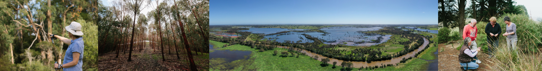
Introduction
The Corner Inlet and Nooramunga local area includes the country of the Gunaikurnai Traditional Owners. At present there are also parts of the local area where formal recognition is not in place.
The Gunaikurnai have a deep, longstanding connection with the area, and have an ongoing role in caring for Country. Corner Inlet Nooramunga lies in a central part of the Gunaikurnai creation story line where Borun, carrying his canoe, travelled from the mountains in the north to the place called Tarra Warackel on the coast (now called Port Albert)15.
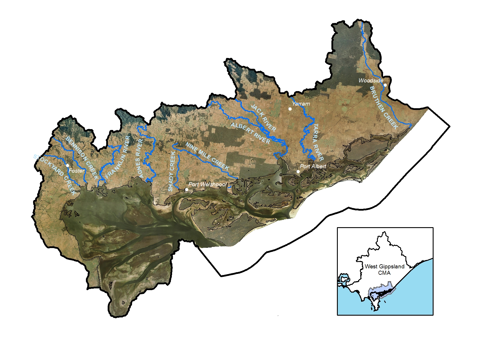
The Corner Inlet and Nooramunga local area includes the lower slopes of the Strzelecki Ranges, the internationally recognised Corner Inlet Ramsar site and the Yanakie Isthmus that connects with Wilsons Promontory.
The western part of the local area has high and generally reliable rainfall and this declines towards the east. Major towns in the local area include Foster, Toora, and Yarram.
Agriculture, forestry, and dryland grazing are important to the local economy. The proximity to Melbourne attracts visitors and those looking for a lifestyle change.
Landcare volunteers and groups in the local area are supported by the South Gippsland Landcare Network and the Yarram Yarram Landcare Network. There is a long history of collaboration between community groups, agencies, and industry on natural resource management issues in this local area with the health of Corner Inlet the focus of efforts.
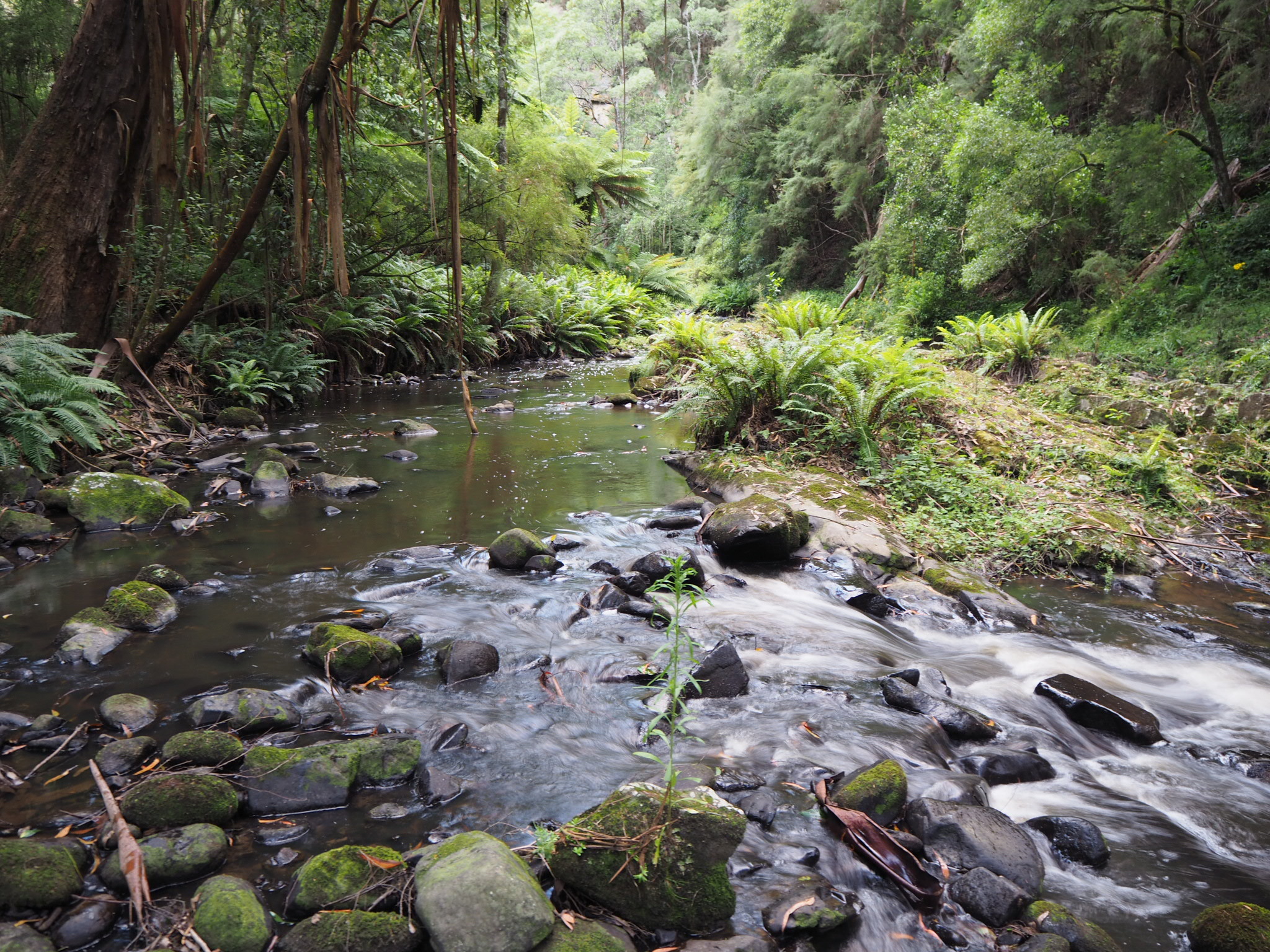
The major river systems in the catchment are the Agnes, Franklin, Albert-Jack, Tarra Rivers and Bruthen Creek. A series of smaller seasonal waterways drain from the Yanakie isthmus.
Surface water is a valuable resource in the catchment supporting agriculture, domestic and urban supply. There is no environmental water held in the South Gippsland basin, however, there is other water in the system that contributes to environmental outcomes1.
Groundwater resources include the Yarram Water Supply Protection Area. It is a major water resource for both irrigation, industry, and town water supplies (Yarram) and has been confirmed to interact with rivers on the southern edges of the Strzelecki Ranges north of Yarram. This aquifer also contains the oil and gas reserves mined offshore in Bass Strait. The Latrobe Group Aquifer contains extremely large volumes of high quality (fresh) groundwater2.
The soils in the local area are part of the Coastal Plain land system that supports dairy, dryland grazing and forestry as well as important vegetation communities. The land system includes dunes, swales and swamps all dominated by wind-blown sands which experience extremes in drainage. Soils are largely intact when covered by native vegetation2;3.
A range of complex habitats and vegetation communities are found in Corner Inlet and Nooramunga. These include sheltered, shallow waters, unique intertidal mudflats, extensive seagrass meadows, and the barrier islands west of 90 Mile Beach. Corner Inlet and Nooramunga supports the only broad-leaf seagrass meadows in Victoria. The area is home to large numbers of birds and a range of rare and threatened species and communities, such as coastal saltmarsh vegetation and areas of mangrove. Further inland are healthy woodlands, grasslands and wetlands that also support a rich diversity of plants and animals.
The Corner Inlet and Nooramunga Marine and Coastal Parks are highly valued for the recreational opportunities they provide and their natural scenic values. Corner Inlet and Nooramunga is now Victoria’s largest bay and inlet fishery providing around 446 tonnes of fresh seafood annually4.

Collaborative action for Biodiversity
The local area incorporates the Corner Inlet Nooramunga and Strzelecki Forests landscapes of interest for Biodiversity Response Planning.
Corner Inlet Nooramunga is a focus area due to its high biodiversity values and the potential to effectively address threats to flora and fauna. In addition to Ramsar values, biodiversity features include important vegetation communities. These include Natural Damp Grasslands of the Victorian Coastal Plain and Subtropical and Temperate Coastal Saltmarsh (Environment Protection and Biodiversity Conservation Act 1999 (Federal)) and associated threatened flora and fauna5.
Snapshot
This section provides an overview of the local area condition and trends for RCS asset themes, including information for a selection of indicators from the state-wide outcomes framework.
Land
![]() Exposed soil ranged between 6.5% and 8.5% in the South Gippsland Shire Council area and 4.1% and 9.9% in Wellington Shire over the period 2000-20195. The percentage of exposed soil in this local area and the region as a whole is much lower than other parts of Victoria and is associated with the moderate climate of the area.
Exposed soil ranged between 6.5% and 8.5% in the South Gippsland Shire Council area and 4.1% and 9.9% in Wellington Shire over the period 2000-20195. The percentage of exposed soil in this local area and the region as a whole is much lower than other parts of Victoria and is associated with the moderate climate of the area.
![]() Non-native pasture (associated with livestock enterprises) is the dominant landcover type in the Corner Inlet Nooramunga local area (69,134 ha), followed by native trees and shrubs (33,772 ha) and irrigated horticulture (6,671 ha)7.
Non-native pasture (associated with livestock enterprises) is the dominant landcover type in the Corner Inlet Nooramunga local area (69,134 ha), followed by native trees and shrubs (33,772 ha) and irrigated horticulture (6,671 ha)7.
![]() The area of irrigated horticulture, exotic woody plants, forestry and urban land uses increased between 1985 and 20197.
The area of irrigated horticulture, exotic woody plants, forestry and urban land uses increased between 1985 and 20197.
![]() The combined production value of agriculture for the year 2015-16 was $166.6M. Milk production was the major commodity followed by cattle and calves10.
The combined production value of agriculture for the year 2015-16 was $166.6M. Milk production was the major commodity followed by cattle and calves10.
Biodiversity
![]() There was a loss of native scattered trees (-39%), native grass herbs (-30%) and natural low cover vegetation (-14%) between 1985 and 20197.
There was a loss of native scattered trees (-39%), native grass herbs (-30%) and natural low cover vegetation (-14%) between 1985 and 20197.
![]() During the same period there was an increase in native shrubs (+23%) and native trees were relatively stable6.
During the same period there was an increase in native shrubs (+23%) and native trees were relatively stable6.
![]() Although only representing a small proportion of the total area, there was a decline in native grasslands (-30%) and seasonal and permanent wetlands (-49%) between 1985 and 20197.
Although only representing a small proportion of the total area, there was a decline in native grasslands (-30%) and seasonal and permanent wetlands (-49%) between 1985 and 20197.
![]() There is over 60,000 ha terrestrial and marine habitat protected through the reserve system (about 30% of the total area)8.
There is over 60,000 ha terrestrial and marine habitat protected through the reserve system (about 30% of the total area)8.
330 ha of habitat on private land was protected through the establishment of Trust for Nature covenants, between 2000-2019.
Water
The Water snapshot provides a summary from the Long Term Water Resource Assessment for Southern Victoria.
The water availability for the major river systems is:
- Agnes River 23.4GL
- Franklin River 28.5GL
- Albert River 68.1GL
- Tarra River 10.6GL
Surface Water
The majority of surface water in these systems is available to the environment.
This includes:
- Agnes River 97%
- Franklin River 98%
- Albert River 98%
- Tarra River 94%1
![]() Since the Sustainable Water Strategy, the cap on the amount of unallocated surface water available for future winter-fill diversions has been revised downwards in several catchments.
Since the Sustainable Water Strategy, the cap on the amount of unallocated surface water available for future winter-fill diversions has been revised downwards in several catchments.
![]() Water availability in the Corner Inlet Nooramunga local area has declined for most river systems when compared with historical estimates, the exception being the Franklin River.
Water availability in the Corner Inlet Nooramunga local area has declined for most river systems when compared with historical estimates, the exception being the Franklin River.
![]() Water availability has been impacted by climate change, with large scale land use changes also a potential contributor. When conditions become drier this affects the amount of water for the environment, as it is provided through above cap flows. Declines in water available to the environment, may have been greater if unallocated licences had been allowed to be taken up by water users1.
Water availability has been impacted by climate change, with large scale land use changes also a potential contributor. When conditions become drier this affects the amount of water for the environment, as it is provided through above cap flows. Declines in water available to the environment, may have been greater if unallocated licences had been allowed to be taken up by water users1.
Groundwater
![]() Groundwater resources include the Yarram Water Supply Protection Area. Monitoring of the Groundwater Management Area shows there has been a long-term decline since the 1970’s due to offshore oil and gas extractions which are connected to the lower aquifer1.
Groundwater resources include the Yarram Water Supply Protection Area. Monitoring of the Groundwater Management Area shows there has been a long-term decline since the 1970’s due to offshore oil and gas extractions which are connected to the lower aquifer1.
Waterways and wetlands
![]() 61 km of waterway and 1,294 ha of riparian land was improved between 2000-2019. This included 304 ha weed control and 140 ha revegetation activities.
61 km of waterway and 1,294 ha of riparian land was improved between 2000-2019. This included 304 ha weed control and 140 ha revegetation activities.
![]() The area of perennial wetlands declined by 52% and seasonal wetlands declined by 47% between 1985 and 20197.
The area of perennial wetlands declined by 52% and seasonal wetlands declined by 47% between 1985 and 20197.
Marine and coast
![]()
![]() An assessment of landcover data indicates there was an increase in the area of mangroves (+17%) and a decrease in the area of saltmarsh (-4%) over the 35-year assessment period from 1985-20197.
An assessment of landcover data indicates there was an increase in the area of mangroves (+17%) and a decrease in the area of saltmarsh (-4%) over the 35-year assessment period from 1985-20197.
Habitat mapping for the Corner Inlet Ramsar site undertaken in 2020 found that:
- There is evidence of a sustained change in the area of intertidal flats in the Corner Inlet Ramsar site
- The current extent of saltmarsh and mangroves is within acceptable limits of change
- The broad and fine leafed seagrass communities in Corner Inlet are dynamic making it important to look at long term trends. Over the last twenty years there have been periods of stability and decline in seagrass cover as well as periods where seagrass has increased for both broad and fine leafed seagrass. Despite this variability it has remained within acceptable limits of change for the Ramsar site9.
Community
![]() The population of the Promontory area of the South Gippsland Shire Council, is forecast to grow by almost 9% for the period 2016-2036.
The population of the Promontory area of the South Gippsland Shire Council, is forecast to grow by almost 9% for the period 2016-2036.
Migration into the area is based around two main population groups – families and retirees. Rural areas tend to attract families and relatively few retirees, whilst towns and coastal areas attract both groups, with far more retirees in coastal areas13.
Current and Future Challenges
![]() Key challenges in the Corner Inlet and Nooramunga local area include:
Key challenges in the Corner Inlet and Nooramunga local area include:
- Poor water quality, fragmentation of habitat and pest plants and animals
- Understanding and responding to the impacts of climate change and coastal processes, such as erosion and sea level rise are also major challenges for agencies, private landholders, and the community
- Engaging with people new to the area and securing sufficient funds for new and ongoing programs, have been highlighted as key concerns by agency partners
- The impact of deer on land, production and the environment, over abundant native fauna species, and the potential increase in marine pests have been highlighted as emerging issues in the Corner Inlet and Nooramunga local area
![]() Future challenges in the Corner Inlet and Nooramunga local area include:
Future challenges in the Corner Inlet and Nooramunga local area include:
- Population related pressures, such as increased recreational use and visitation
- Competition for land and intensification of land management practices
Managing the impacts of development on-shore and off-shore may also become a greater challenge in the future.
The impacts of deer on land, production and the environment, over abundant native fauna species, and the potential increase in marine pests have been highlighted as emerging issues in the Corner Inlet and Nooramunga local area.
Overview of current and future management challenges for the Corner Inlet and Nooramunga Local Area
| KEY MANAGEMENT CHALLENGES FOR LAND, WATER, BIODIVERSITY, COAST AND MARINE | LAND | WATER | BIODIVERSITY | COAST AND MARINE | COMMUNITY CONCERNS |
|---|---|---|---|---|---|
| Unsustainable water use and altered water regime | ✔ | ✔ | ✔ | ||
| Erosion and soil degradation | ✔ | ✔ | ✔ | ||
| Pest plants | ✔ | ✔ | ✔ | ✔ | ✔ |
| Pest animals | ✔ | ✔ | ✔ | ✔ | |
| Land management practices (includes timber harvesting, land and livestock management practices) | ✔ | ✔ | |||
| Changing agricultural land uses and viability of agriculture | ✔ | ✔ | |||
| Poor water quality (as the result of excess nutrients, sedimentation, oil spills and other pollutants) | ✔ | ✔ | ✔ | ✔ | |
| Recreational use and visitation impacts (includes activities and access) | ✔ | ✔ | ✔ | ||
| Population growth and urban expansion | ✔ | ✔ | ✔ | ✔ | |
| Habitat fragmentation | ✔ | ✔ | ✔ | ||
| Seawalls | ✔ | ||||
| Coastal erosion and hazards | ✔ | ✔ | |||
| Inappropriate fire regimes | ✔ | ✔ | |||
| Dredging and offshore development | ✔ | ||||
| Climate change and related extreme events (e.g. wildfire, flood, storm surge, sea level rise). | ✔ | ✔ | ✔ | ✔ |
Opportunities and Priorities
Traditional Owner priorities
The Traditional Owners of this local area, the Gunaikurnai people, have cared for this Country for thousands of years. Their place-based aspirations and priorities are outlined in the Gunaikurnai Whole of Country Plan.
There are long established partnerships and a solid foundation of catchment stewardship in the Corner Inlet Nooramunga local area. There is strong commitment from agencies and the community in this local area to continue to take a whole of landscape approach to catchment, land and water management.
New opportunities include planning and taking action for climate change, exploring alternative markets for water quality improvement, supporting succession of volunteer organisations, and looking for ways to support outcomes for Wilsons Promontory through action along the Yanakie Isthmus.
The tables below set out the overarching Traditional Owner priorities that are relevant across all local areas and the other opportunities and priorities for agency partners and the community for this local area.
| TRADITIONAL OWNER PRIORITIES |
|---|
| ◾ Protecting cultural heritage from pressures associated recreation, land use changes and climate |
| ◾ Actively managing the water, fire, wildlife and biodiversity on Country in a culturally appropriate way |
| ◾ Having the authority to lead managing Country on behalf of the rest of the community |
| ◾ Seeking carbon production through forest restoration |
| ◾ Participating in economic opportunities, including employment and enterprise development associated with caring for Country |
| ◾ Access to water to restore customary practices, protect cultural values and uses and heal Country |
| ◾ Secure water rights to restore and reserve waterways and practice self-determination on how and where water is used for cultural, environmental or economic purposes. |
| OTHER LOCAL AREA OPPORTUNITIES AND PRIORITIES |
|---|
| ◾ Protect and improve biodiversity including through permanent protection and targeted actions to reduce threats |
| ◾ Undertake targeted predator control to protect migratory and resident birds |
| ◾ Implement actions to maintain the ecological character of the Corner Inlet Ramsar site |
| ◾ Investigate options to address the impacts of climate change on the Nooramunga barrier islands and low-lying coastal land |
| ◾ Manage potential impacts from development pressures on Ramsar values through regulatory processes |
| ◾ Increase community awareness of the environment and provide opportunities for community participation |
| ◾ Investigate and implement planning scheme measures to manage potential impacts from development / population growth on agricultural land, wetlands, water quality and biodiversity |
| ◾ Support farmers to implement practices that improve land management and reduce off-site impacts |
| ◾ Support Traditional Owners’ aspirations for and participation in land, water and biodiversity management |
| ◾ Investigate and implement options to address water recovery targets (for Traditional Owner, environmental and recreational values) |
| ◾ Complete works to protect and rehabilitate waterways and riparian areas. |
Community perspectives
What does the Corner Inlet Landscape look like in the future?
“Pockets of remnant vegetation protection that link all the waterways together.”
“No loss of productivity and better management of soils and fertilisers.”
“The rivers are healthy with stock excluded from source to sea.”
“Steep gullies on private and public land revegetated.”
“Increase in seagrass beds, clear water in rivers, buffer zones along waterways entering the inlet.”
The top land, water and biodiversity management actions identified by community members were:
- Retain and restore native vegetation communities
- Control invasive plants
- Fencing of waterways and native vegetation
- Community engagement and participation
- Control invasive animals
- Improve our knowledge of land, water and biodiversity and the effectiveness of our actions
- Collaboration between agencies and community on local projects.
The top areas of focus for climate change adaptation were:
- Maintain a diversity of habitats, environments and species to maximise the chance of survival
- Incorporate traditional ecological knowledge into climate change adaptation
- Conduct monitoring and research that improves our ability to plan for and adapt to climate change.
The top areas for helping communities and industries to participate in land, water and biodiversity management were:
- Collaboration between agencies and community/industry on projects at a local level
- Grants or incentives to undertake projects
- Information/advice to improve knowledge.
Management Directions and Regional Outcomes
Management directions are the overarching strategies to guide agency and community collaboration. The agency and community priorities outlined above will help to realise the management directions at the local area scale.
Implementation will be guided by regular Local Area partnership forums and implementation planning processes that prioritise effort with consideration to value for money, and issues of feasibility and risk.
Priority management directions have been defined for each theme: Land, Water, Biodiversity, Coastal and Marine, Traditional Owners, Community and Climate Change.
The RCS outcomes hierarchy can be found here with a more detailed matrix showing how the medium term outcomes align to local areas here.
Further details on RCS implementation can be found here.
References
- DELWP. Long Term Water Resource Assessment for Southern Victoria. Basin by Basin Results. East Melbourne: Department of Environment, Land, Water and Planning, 2020
- WGCMA. West Gippsland Regional Catchment Strategy 2013-2019. Traralgon: West Gippsland Catchment Management Authority, 2013
- WGCMA. West Gippsland Soil Erosion Management Plan. West Gippsland Catchment Management Authority, 2008
- SIV. Corner Inlet – Nooramunga Fishery. Seafood Industry Victoria. n.d
- DELWP. Biodiversity Response Planning Fact Sheets. Department of Environment, Land, Water and Planning. [Online] 2021
- Van Dijk, A and Summers, David. Australia’s Environment Explorer, The Australian National University. Exposed Soil. 27 November 2020
- DELWP. Victorian Land Cover Time Series Data 1985-2019. East Melbourne: Department of Environment, Land, Water and Planning, 2020a
- DAWE. Collaborative Australian Protected Areas Database (CAPAD) – Terrestrial & Marine, [Spatial Layer] Canberra: Department of Agriculture, Water and the Environment, 2021
- Brooks, S and Hale, J. Corner Inlet Ramsar Site Habitat Mapping, September 2020. 2020
- ABS. Agriculture Census: Agricultural Data – 2005-06, 2010-11 and 2015-16. Canberra: Australian Bureau of Statistics, 2020
- RMCG. West Gippsland RCS Review and Renewal. Final Report. Prepared by RMCG for the West Gippsland Catchment Management Authority, 2020
- BLCAC. Bunurong Land Council Aboriginal Corporation Appointed Registered Aboriginal Parties Area. Frankston: Bunurong Land Council Aboriginal Corporation, Undated
- id. South Gippsland Shire Population Forecast. 17 3 2020
- DELWP. Draft Gippsland Adaptation Strategy. s.l.: Department of Environment, Land, Water and Planning, n.d
- GKTOLM. Gunaikurnai and Victorian Government Joint Management Plan. Bairnsdale: Gunaikurnai Traditional Owner Land Management Board. 2018.