Introduction
The West Gippsland region contributes:
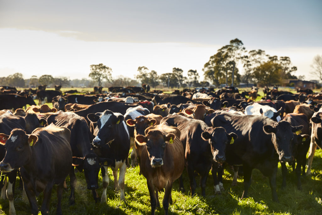
- 23% of Australia’s milk production
- Most of Victoria’s electricity and gas (offshore)
- About 60% of Melbourne’s water.
West Gippsland’s land and natural resources underpin the regional economy. Most of the main industries in the region have a direct connection to land including:
- Agriculture and forestry
- Energy production (electricity, oil and gas)
- Supply of potable and irrigation water
- Food product manufacturing and processing
- Construction and residential building.
The region’s variety of soil types reflect the geology, climate, organic activity and age (e.g. degree of weathering). Most of the region’s soils are moderately well structured and support natural ecosystems, forestry and the highly diverse agricultural sector.
The Great Dividing Range, Strzelecki Ranges and the western half of the region receive high rainfall. The western and southern parts of the region are some of the most productive agricultural areas in the state due to the combination of reliable rainfall and fertile soils. The Gippsland Lakes and Hinterland and the Gippsland Coastal Plains local areas are in rain shadow areas, and are more susceptible to the effects of drought. Access to water for irrigation is particularly important in the greater Macalister Irrigation Area.
The Great Dividing Range, the eastern Strzelecki Ranges and Wilsons Promontory are less modified and support extensive areas of native vegetation. These areas have a substantial proportion of the region’s public land which is valued for its natural features.
Some areas of the region remain under pressure from development with land changing towards urban and rural residential development. For example, in Bass Coast, South Gippsland and Baw Baw local government areas, there is considerable competition for land between rural residential development, urban expansion (including the expansion of Melbourne’s peri-urban fringe) and agriculture1.
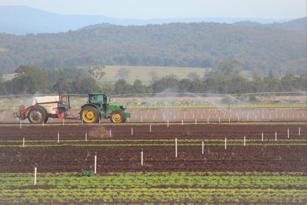
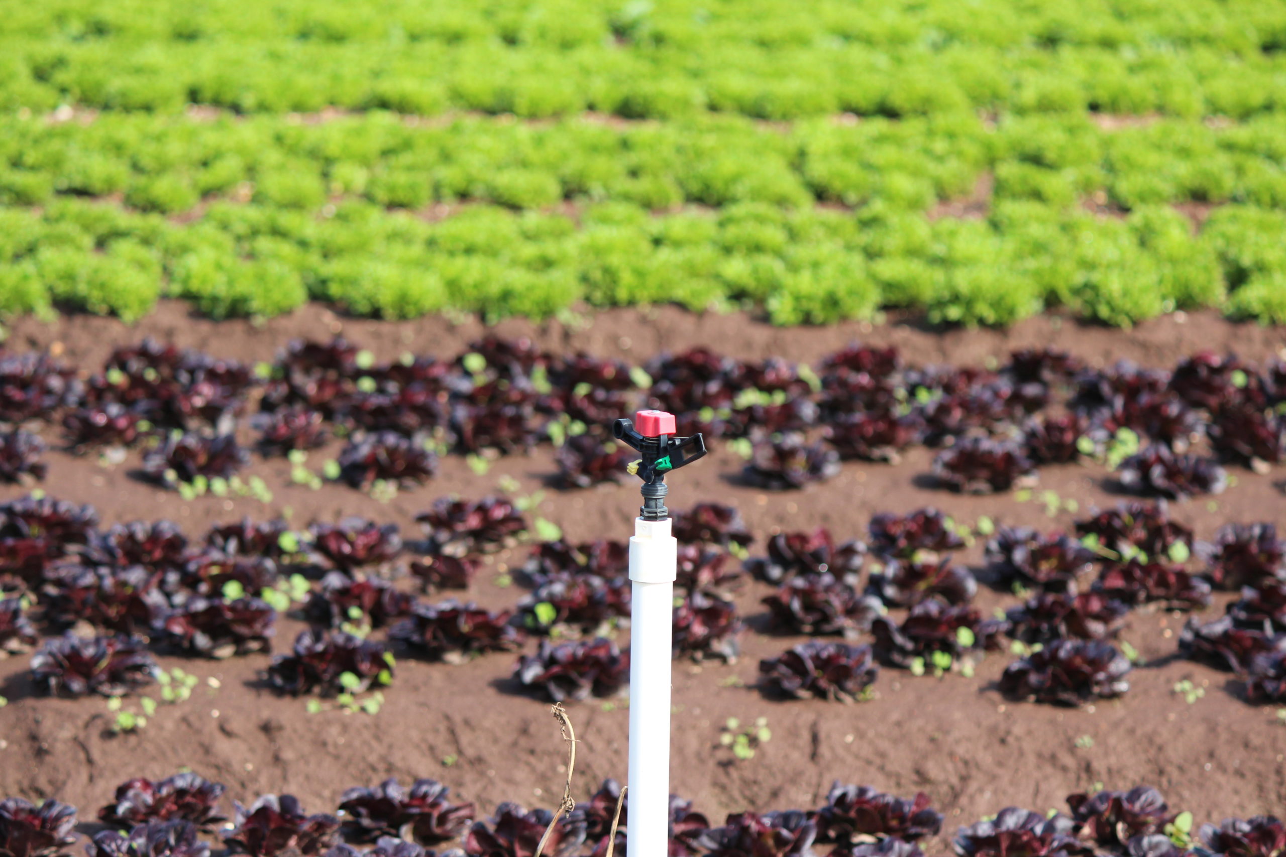
Changes in agricultural enterprise type and intensity are also being observed with irrigated horticulture increasing in the region (see below for more detail).
Bass Coast Distinctive Area and Landscape
The Bass Coast was declared a Distinctive Area and Landscape under the Planning and Environment Act 1987. The declaration triggers the requirement to prepare a Statement of Planning Policy that will help guide land use decision making to ensure the unique features of the Bass Coast are protected for current and future generations. It sets out a 50-year vision, a framework plan and the long-term needs for the integration of decision making and planning.
Renewable Energy Zones
The Victorian Government has legislated renewable energy targets of 25 per cent of electricity generation by 2020, 40 per cent by 2025, and 50 per cent by 2030.
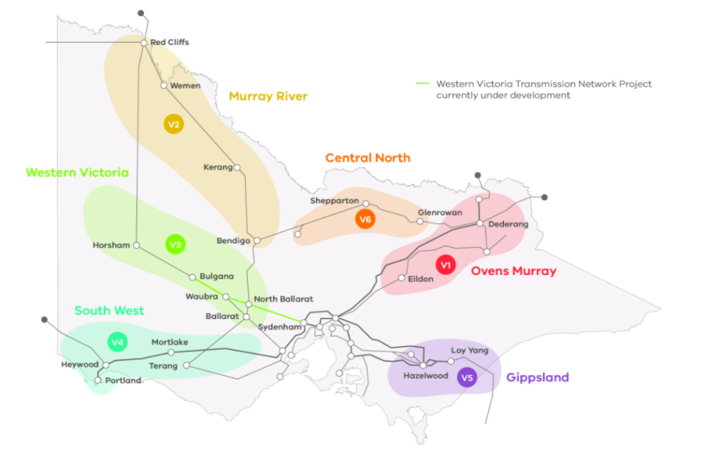
The development of Renewable Energy Zones (REZs) across Victoria is part of the state’s approach to energy transformation. REZs are areas of abundant renewable energy resources such as solar and wind, where further development can contribute to the delivery of secure and clean energy for Victoria. Gippsland has been identified as one of six REZs in Victoria. The development of the Gippsland REZ will result in the transition from coal fire-power to planned development of renewable energy resources7.
Condition and Trends
Soil health
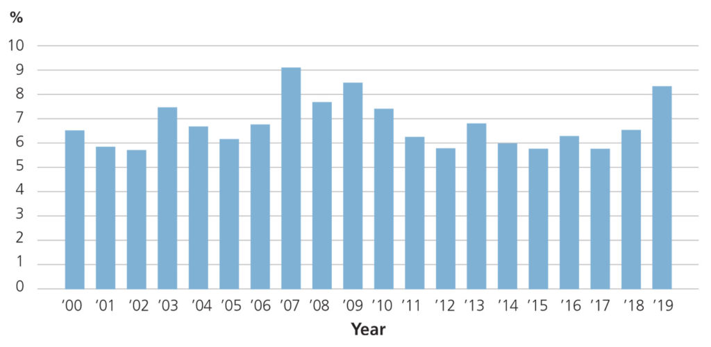
The West Gippsland region has had low risk of widespread erosion from bare (exposed) soils in dryland production areas over the last nineteen years, with average annual exposed soil typically less than 10%6. However, erosion risk is present in parts of the catchment with steep slopes and approximately 24% (135,000 ha) of private land has been modelled as being at high or very high risk of gully and tunnel erosion2;3.
Tunnel erosion is a hazard historically associated with vegetation clearing on steep slopes in areas such as the Strzelecki Ranges. Sheet, rill and bank erosion are other potentially threatening processes. Soils generally have a low susceptibility to wind erosion except for a few localised high-risk areas within the Bunurong Coastal local area (around Waratah Bay, the upper Powlett River, Screw Creek and Pound Creek), the Corner Inlet and Nooramunga local area (Nine Mile Creek) and parts of the Gippsland Coastal Plains.
Overall, the Corner Inlet and Nooramunga local area and Strzelecki’s are at most risk for all types of erosion2;3. The Great Dividing Range and Foothills and parts of the Gippsland Coastal Plains are also highlighted as areas at risk based on the total hectares of high to very high erosion risk.
Land use
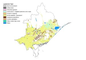
The recently released Victorian Land Cover Time Series 1985-2019, shows land use across the region, for broad classes and trends over time4.
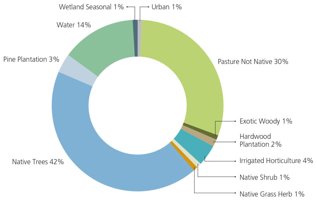
The pie chart (below) shows that native vegetation is the main landcover incorporating native trees, shrubs and grass herb. This is followed by agriculture (non-native/introduced pasture and irrigated horticulture).
Note that the ‘native grass herb’ class includes Note that the ‘native grass herb’ class includes grasslands that have resulted from the clearing of trees and/or shrub cover and is likely to include areas of degraded native grassland used for grazing.
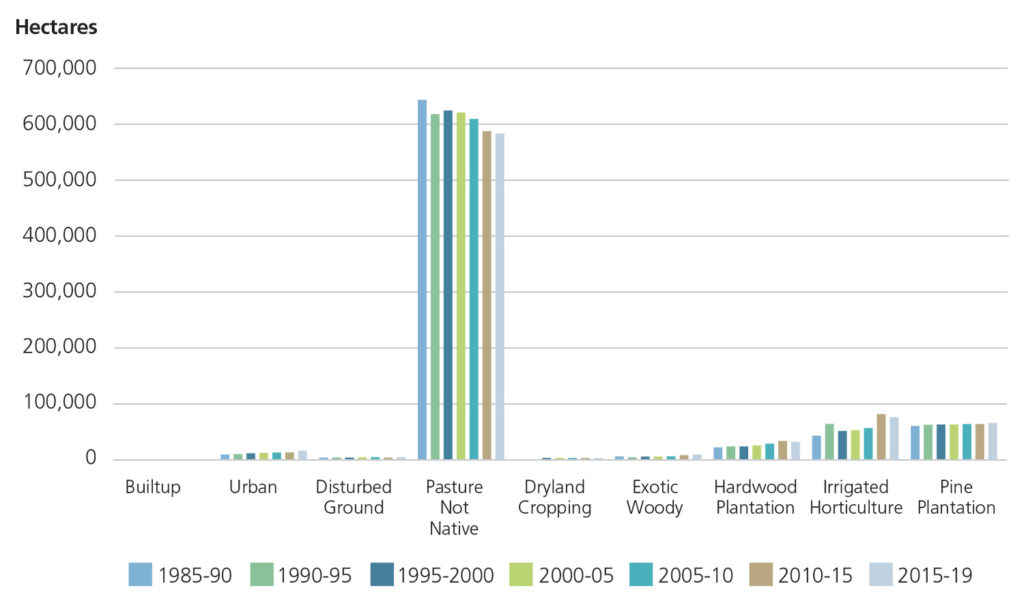
The extent of land use graph (below) shows an increase in urban (including built up), irrigated horticulture, plantation (hardwood and pine) and dryland cropping. Grazing land uses (associated with non-native pasture) declined over the last 35 years. This data will be used to monitor future trends.
Agricultural commodities
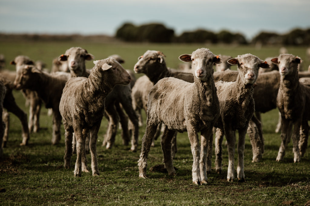
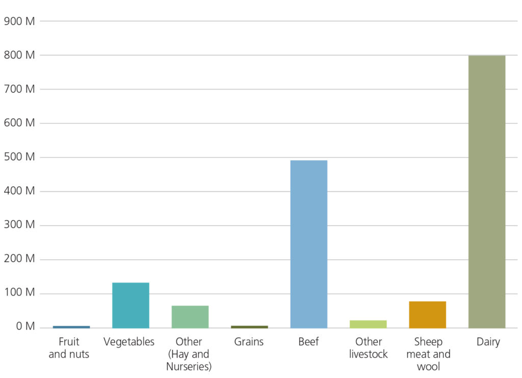
Agriculture is an important contributor to the regional economy. In 2018-19 the gross value of agriculture in the West Gippsland region was over $1.62 billion, representing approximately 10% of the state’s agricultural income.
Dairy is the dominant commodity in the region ($799M) followed by beef ($494M) and vegetables ($135M). Based on gross value, West Gippsland produces 29% of Victoria’s milk, 20% of the beef and 5% of fruit and vegetables5.
Major Threats and Challenges
The key threats and challenges influencing land resources include:
- Agricultural practices
- Climate change and variability
- Invasive plants and animals
- Soil degradation
- Continued development
- Land use change.
Maintaining the viability of the agricultural sector whilst also protecting and enhancing biodiversity remains a key challenge for land managers.
Agricultural practices
Agricultural practices are a major influence on land condition across the region. Agricultural producers are progressively taking up land management practices that protect the resource on which production depends. Examples include stock exclusion from rivers and streams, weed control, water use efficiency and nutrient management, reduced or no-till farming, and planting cover crops1.
Climate and Weather
Climate and weather have a strong influence on vegetative cover. Increased seasonal temperatures can increase water use by plants or reduce the growth rates of plants.
A drier and warmer climate is expected to impact on the region’s land resources, through changes to soil health and agricultural productivity. Agricultural productivity may be affected through drought and heat stress on plants and animals. Increased pest plant and animal plus disease movement and establishment across Victoria may also have an effect.
An increased incidence of fire may lead to the destruction of native vegetation and habitat, loss of crops and livestock, smoke taint for wine producers (as experienced during Victoria’s ‘Black Summer’ bushfires), and lost productivity due to the preventative actions required on high-fire risk days. Following all major fire events there is pressure for greater fuel reduction burning. Recent research is showing that this type of action is effective but only in relatively close proximity to the assets being protected1.
Soil degradation
A range of processes influence the condition of soil and land including several types of erosion, soil structure decline, acidification and salinity. Erosion is a challenge in the steep slopes in the Strzelecki’s and the Great Dividing Range.
Naturally occurring (primary) salinity is present within the catchment. Induced salinity (secondary salinisation) occurs in some areas because of human activities. Potential causes of salinity include land clearing, irrigation and seawater intrusions to low lying tidal floodplains. Significant areas of land at high salinity risk (with water tables less than two metres) occur in areas outside the Macalister Irrigation District, particularly in low lying coastal areas of South Gippsland that are predominantly used for dryland grazing1.
Invasive (pest) plants and animals
Pest plants continue to be a threatening process to land health including ragwort, gorse, blackberry, serrated tussock and African lovegrass. Similarly, foxes, rabbits and deer are the predominant invasive animal species found across the region.
Pest plants and animals continue to be a management challenge for land managers and the broader community. Some species appear to be becoming more widespread and/or abundant. The most prominent of these is deer, with hog and sambar deer becoming more common in West Gippsland.
The suitability of the region for these invasive species, particularly weeds, will alter with climate change. Changes in climate will impact on weeds in two main ways, firstly the range of weed species present in the West Gippsland region will change, and secondly the invasiveness of weed species will change favouring some species over others.
The major drivers of change for the Land theme were identified through consultation with partner organisations as outlined below1.
Major drivers of change – Land
| CLIMATE CHANGE | POPULATION AND DEMOGRAPHICS TRENDS | LAND USE CHANGE | INDUSTRY OUTLOOK |
|---|---|---|---|
| ▪ Extreme events (fire, floods) – impacting soil health, and on farm assets ▪ Geographical shifts in land capability due to climate stressors ▪ Impacts on livestock production and harvesting as a result of extreme climate conditions and seasonal variability ▪ Change in the range of weed and pest animal species present in the region and their invasiveness | ▪ Population increases are outstripping predictions in local government areas closer to Melbourne ▪ An increase in absentee and hobby farmers ▪ An increase in farm aggregation with greater single ownership and company/corporate (including international and interstate) ownership of land holdings | ▪ Continuing trend of changes in land use toward larger scale agricultural operations including horticulture (increased soil exposure) and urban expansion (with increased runoff) ▪ An increase in horticulture within the Macalister Irrigation District (MID) – with corresponding increases in intensity | ▪ A general increase in the intensification in agriculture systems across the region ▪ Planned brown coal power station closures (Hazelwood, Yallourn and Loy Yang) within the Latrobe Valley ▪ More renewable energy projects (e.g. large wind or solar farms) ▪ Potential sand mining in the region and onshore gas exploration ▪ An increase in extractive industries (to supply the construction industry) |
Opportunities and Management Directions
Priority management directions have been identified for the Land theme through a review of RCS3 and consultation with Traditional Owners, the community and partner organisations.
Established management directions will be delivered through existing sub-strategies and action plans.
Opportunities will be further developed or pursued through RCS implementation to help support Integrated Catchment Management in the region.
Priority opportunities and management directions for the Land Theme
| MANAGEMENT DIRECTION | DETAILS | ESTABLISHED MANAGEMENT DIRECTION | OPPORTUNITY | PARTNERS |
|---|---|---|---|---|
| Implement programs to support the adoption of sustainable land management practices | Addressing soil health and groundcover | ✔ | DJPR, WGCMA, Industry bodies | |
| Implement the Lake Wellington Land and Water Management Plan, expanding to the irrigators beyond the MID | Priorities include irrigation efficiency, managing the impact of salinity and high water tables, retention of sediment and nutrients on farm, protecting cultural values and industry partnerships | ✔ | WGCMA, DJPR, DELWP, EPA, SRW, Industry bodies, GLaWAC | |
| Implement the Corner Inlet Water Quality Improvement Plan | Priorities include supporting adoption of best management practices (agricultural and forestry), catchment works and community partnerships. | ✔ | DJPR, WGCMA, Industry bodies, Landcare | |
| Ensure the hydrological changes associated with irrigation modernisation are identified and considered in planning and decision making about water resource allocation | ✔ | SRW, WGCMA, DELWP | ||
| Deliver integrated catchment management initiatives in priority catchments | Perry River and Providence Ponds, Powlett River catchments (priorities in 2021) | ✔ | WGCMA, Traditional Owners, Community representatives, Landcare, DELWP, DJPR, Local Government, Parks Victoria, TfN | |
| Work with the community in priority areas to prepare whole of landscape integrated catchment management plans | Initial priorities include the Tarwin catchment and the Strzelecki’s | ✔ | As above | |
| Establish improved systems and processes for the collection of land health data including use of new technology | ✔ | WGCMA, Agriculture Victoria | ||
| Develop tools and information products to support agricultural producers to adapt farming systems | Priorities include climate change adaption, emissions, and increasing the resilience of farm businesses | ✔ | Agriculture Victoria, WGCMA, Agricultural industry bodies | |
| Investigate actions to address emerging environmental biosecurity risks | Considering risks associated with climate change, population growth and land-use change. | Agriculture Victoria, WGCMA, DELWP, Agricultural industry bodies | ||
| Develop planning policy options to address the impacts of population growth and urban expansion on agricultural land and environmental values | Implementation of the Bass Coast DAL and measures (where required) in other local planning schemes | ✔ | Local Government, DELWP, WGCMA |
Regional Outcomes
This section sets out the long term (20-year) and medium term (6-year) outcomes as they relate to the region’s land assets. The outcomes include those aligned with the statewide outcomes framework as well regionally specific outcomes developed in collaboration with RCS partners.
The RCS outcomes hierarchy can be found here with a more detailed matrix showing how the medium term outcomes align to local areas here.
Long term outcomes – by 2041 we will:
Regionally specific outcomes:
- Improve soil health and the adoption of sustainable land management practices
- Increase the gross value of production from agriculture by an average of 5% p.a
- Establish additional local planning scheme measures to protect strategic agricultural and environmental assets*.
Medium term outcomes – by 2027:
Aligned to the statewide outcomes framework:
- Groundcover has been maintained within the 2000-2019 average (≻90%)
Regionally specific outcomes:
- 80% of participants in best management practice programs have increased awareness of sustainable land management practices
- 60% of participants in best management practice programs have taken action to improve their practices
- Measures to protect strategic agricultural and environmental assets in local planning schemes have been identified.
Footnotes:
*Where required, informed by strategic assessment. Existing measures may be sufficient for some local planning schemes.
References
- RMCG. West Gippsland RCS Review and Renewal. Final Report. Torquay: RM Consulting Group for the West Gippsland Catchment Management Authority, 2020
- WGCMA. West Gippsland Regional Catchment Strategy 2013- 2019. Traralgon: West Gippsland Catchment Management Authority, 2013
- WGCMA. West Gippsland Soil Erosion Management Plan. West Gippsland Catchment Management Authority, 2008
- DELWP. Victorian Land Cover Time Series Data 1985 – 2019. [Spatial data] East Melbourne: Department of Environment, Land, Water and Planning, 2020
- ABS. Agricultural gross value of production by NRM (CMA) region for Victoria. 2018-19. [ABS Catalogue Number 7503]. Australian Bureau of Statistics, 2021
- Van Dijk, A and Summers, David. Australia’s Environment Explorer, The Australian National University. Exposed Soil. [Online].
- DELWP. Victorian Renewable Energy Zones Development Plan. Directions Paper. February 2021. Melbourne. Department of Environment, Land, Water and Planning, 2021

